Geographic Information Systems in Czech monument care Geographic Information Systems in Czech monument care @ 2016 information system renewed • Geomatics in Projects, Chateau Kozel 5. 10. 2016 • Zuzana Syrová a Šimon Eismann Zuzana Syrová a Šimon Eismann National Heritage Institute
Transcript
Geographic Information Systems in Czech monument careGeographic Information Systems in Czech monument care@ 2016
information system renewed
• Geomatics in Projects, Chateau Kozel 5. 10. 2016
• Zuzana Syrová a Šimon Eismann Zuzana Syrová a Šimon Eismann National Heritage Institute
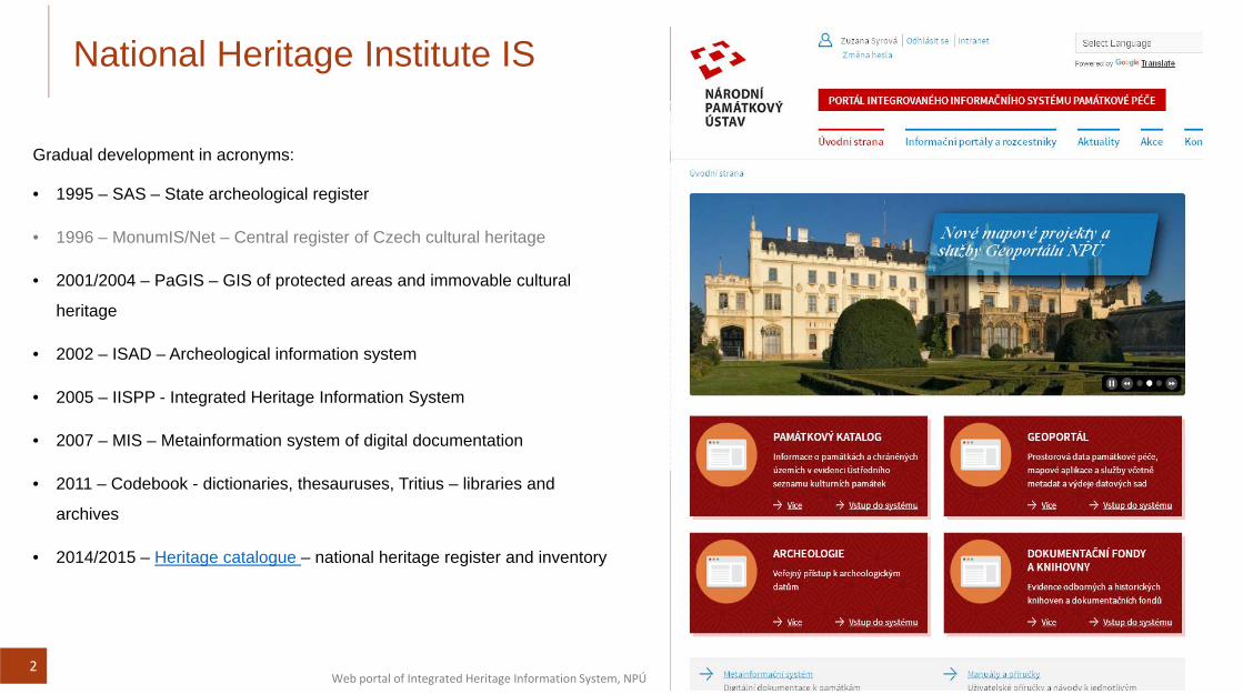
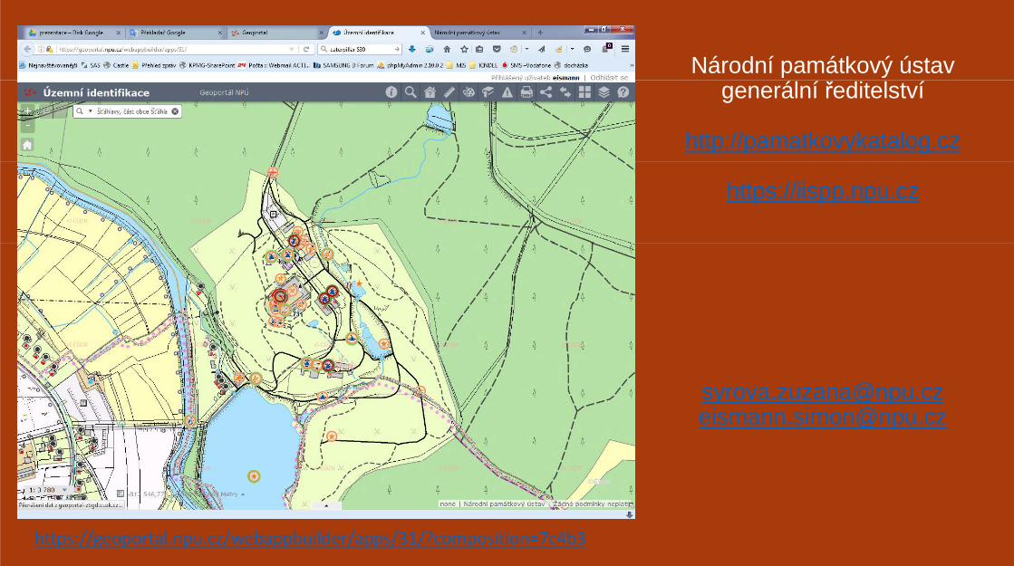
National Heritage Institute IS
Gradual development in acronyms:
• 1995 – SAS – State archeological register1995 SAS State archeological register
• 1996 – MonumIS/Net – Central register of Czech cultural heritage
• 2001/2004 – PaGIS – GIS of protected areas and immovable cultural
heritage
• 2002 – ISAD – Archeological information system
• 2005 IISPP Integrated Heritage Information System• 2005 – IISPP - Integrated Heritage Information System
• 2007 – MIS – Metainformation system of digital documentation
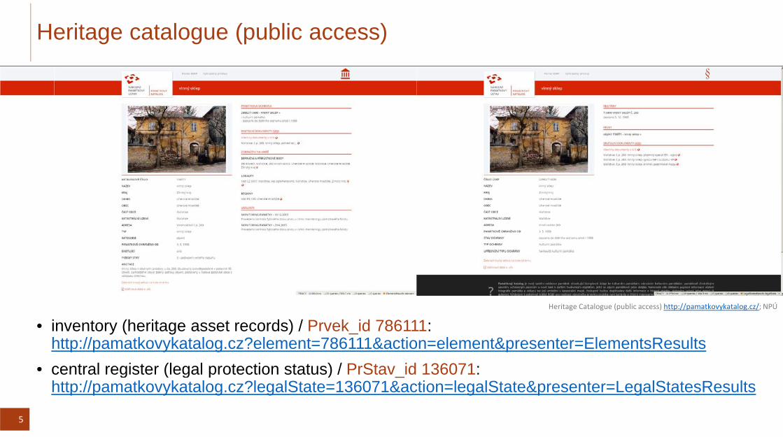
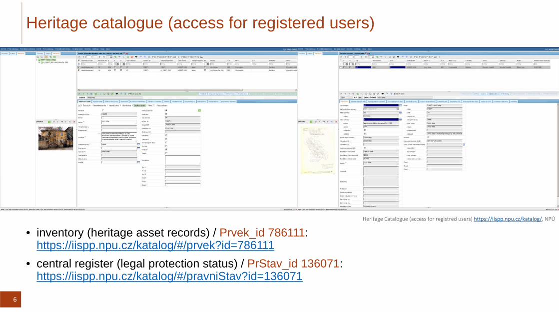
• 2014/2015 – Heritage catalogue – national heritage register and inventory
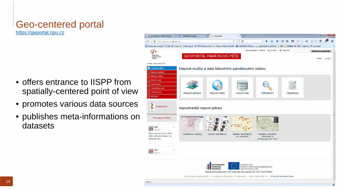
2Web portal of Integrated Heritage Information System, NPÚ
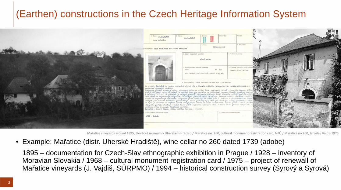
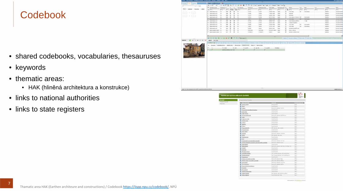
(Earthen) constructions in the Czech Heritage Information System
Mařatice vineyards around 1895, Slovácké muzeum v Uherském Hradišti / Mařatice no. 260, cultural monument registration card, NPÚ / Mařatice no 260, Jaroslav Vajdiš 1975
• Example: Mařatice (distr. Uherské Hradiště), wine cellar no 260 dated 1739 (adobe)1895 – documentation for Czech-Slav ethnographic exhibition in Prague / 1928 – inventory of Moravian Slovakia / 1968 – cultural monument registration card / 1975 – project of renewall of
3
g p jMařatice vineyards (J. Vajdiš, SÚRPMO) / 1994 – historical construction survey (Syrový a Syrová)
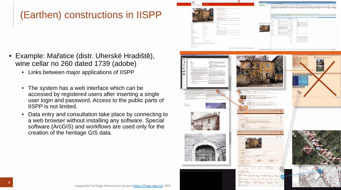
(Earthen) constructions in IISPP
E l M ř ti (di t Uh ké H diště)• Example: Mařatice (distr. Uherské Hradiště), wine cellar no 260 dated 1739 (adobe)
• Links between major applications of IISPP
• The system has a web interface which can be accessed by registered users after inserting a single user login and password. Access to the public parts of IISPP is not limited.
• Data entry and consultation take place by connecting to a web browser without installing any software. Special software (ArcGIS) and workflows are used only for the creation of the heritage GIS data.
4Integrated Heritage Information System https://iispp.npu.cz/; NPÚ
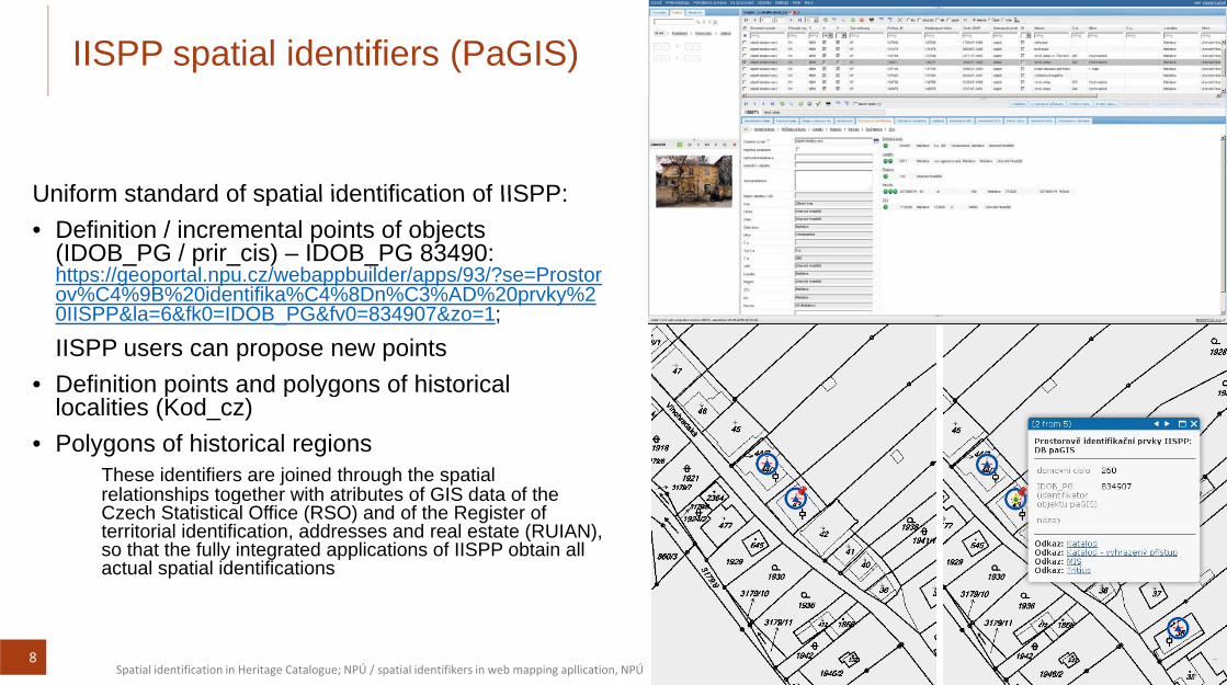
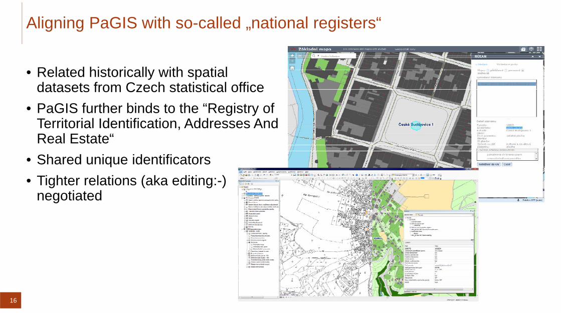
IISPP users can propose new points • Definition points and polygons of historical p p yg
localities (Kod_cz)• Polygons of historical regions
These identifiers are joined through the spatial relationships together with atributes of GIS data of therelationships together with atributes of GIS data of the Czech Statistical Office (RSO) and of the Register of territorial identification, addresses and real estate (RUIAN), so that the fully integrated applications of IISPP obtain all actual spatial identifications
8Spatial identification in Heritage Catalogue; NPÚ / spatial identifikers in web mapping apllication, NPÚ
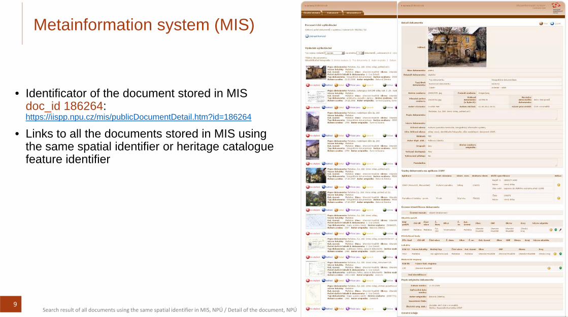
Metainformation system (MIS)
Id tifi t f th d t t d i MIS• Identificator of the document stored in MIS doc_id 186264: https://iispp.npu.cz/mis/publicDocumentDetail.htm?id=186264
• Links to all the documents stored in MIS usingLinks to all the documents stored in MIS using the same spatial identifier or heritage catalogue feature identifier
9Search result of all documents using the same spatial identifier in MIS, NPÚ / Detail of the document, NPÚ
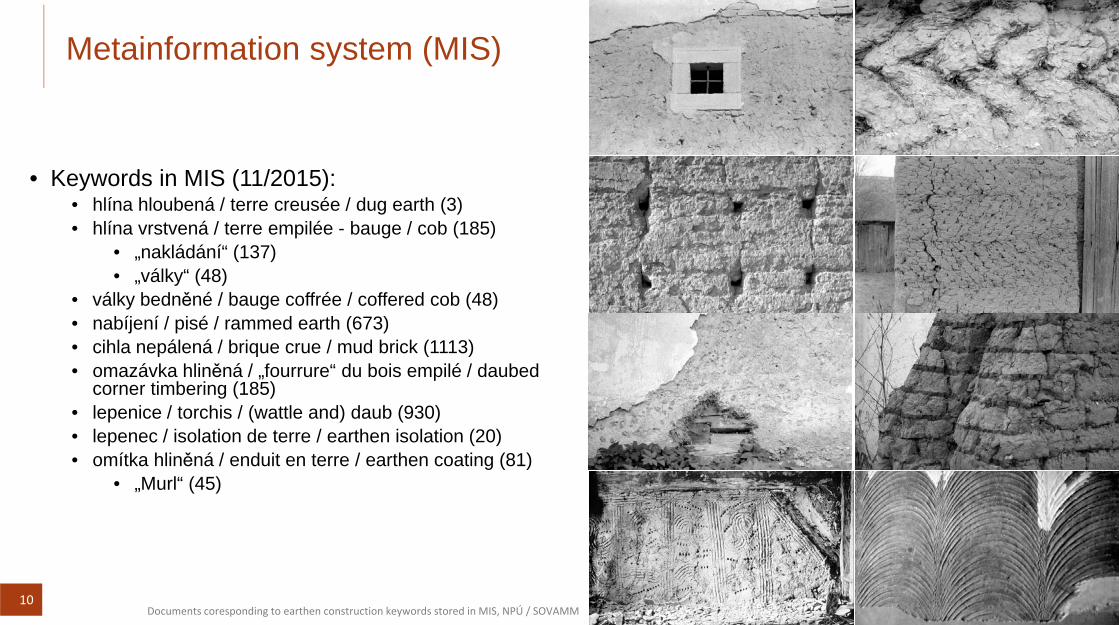
Metainformation system (MIS)
• Keywords in MIS (11/2015):• Keywords in MIS (11/2015):• hlína hloubená / terre creusée / dug earth (3)• hlína vrstvená / terre empilée - bauge / cob (185)
10Documents coresponding to earthen construction keywords stored in MIS, NPÚ / SOVAMM
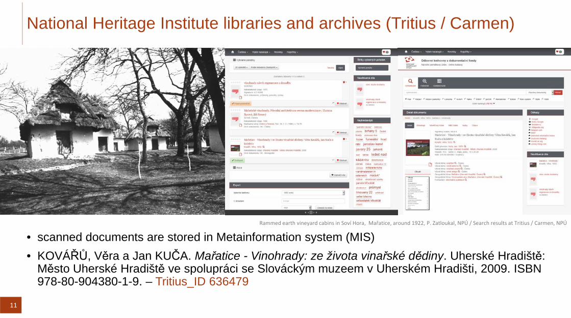
National Heritage Institute libraries and archives (Tritius / Carmen)
Rammed earth vineyard cabins in Soví Hora, Mařatice, around 1922, P. Zatloukal, NPÚ / Search results at Tritius / Carmen, NPÚ
• scanned documents are stored in Metainformation system (MIS)• KOVÁŘŮ, Věra a Jan KUČA. Mařatice - Vinohrady: ze života vinařské dědiny. Uherské Hradiště:
Město Uherské Hradiště ve spolupráci se Slováckým muzeem v Uherském Hradišti, 2009. ISBN
11
p p ý ,978-80-904380-1-9. – Tritius_ID 636479
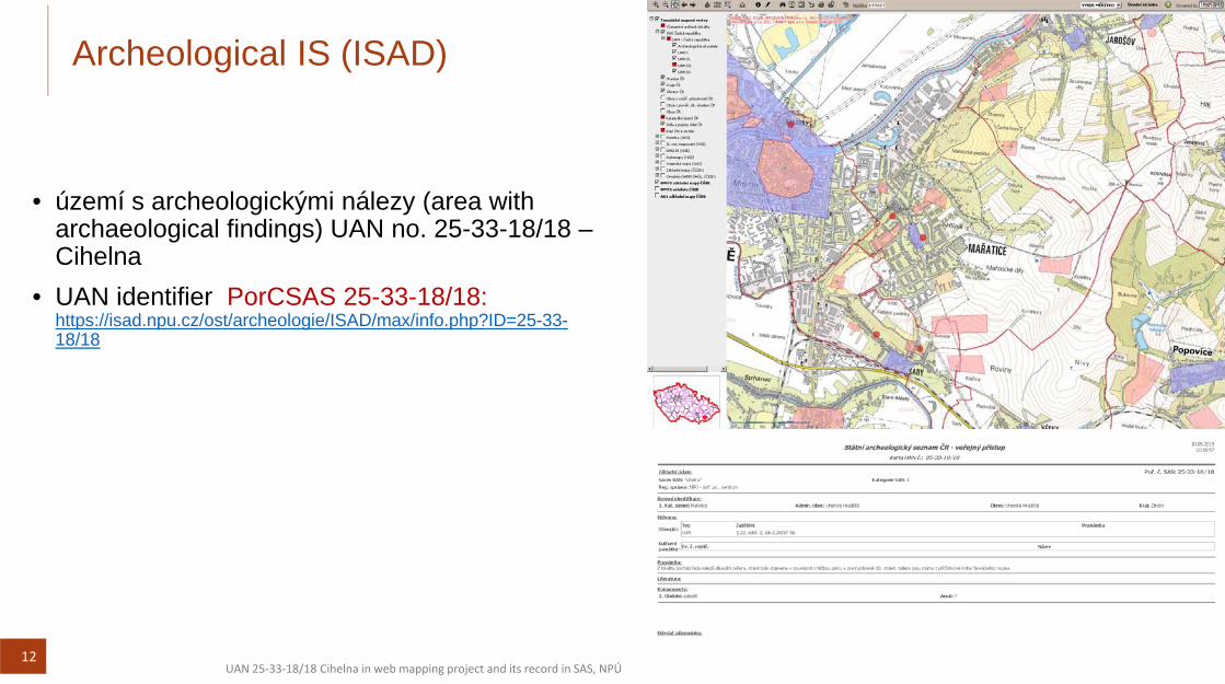
Archeological IS (ISAD)
ú í h l i ký i ál ( ith• území s archeologickými nálezy (area with archaeological findings) UAN no. 25-33-18/18 –Cihelna
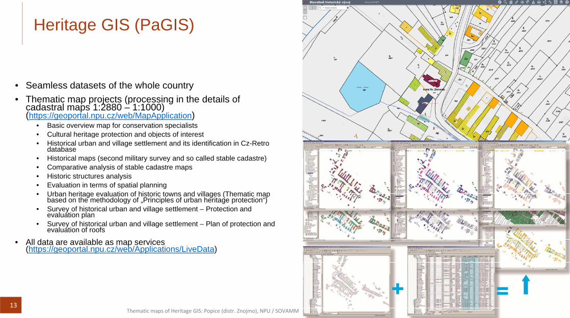
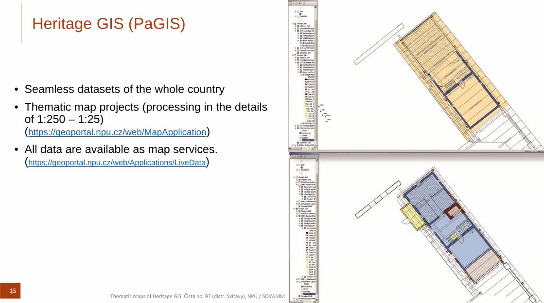
• Basic overview map for conservation specialists• Cultural heritage protection and objects of interestCultural heritage protection and objects of interest• Historical urban and village settlement and its identification in Cz-Retro
database• Historical maps (second military survey and so called stable cadastre)• Comparative analysis of stable cadastre maps• Historic structures analysis• Evaluation in terms of spatial planning• Urban heritage evaluation of historic towns and villages (Thematic map
based on the methodology of „Principles of urban heritage protection“)• Survey of historical urban and village settlement – Protection and
evaluation plan• Survey of historical urban and village settlement – Plan of protection and
l ti f fevaluation of roofs
• All data are available as map services(https://geoportal.npu.cz/web/Applications/LiveData)
13Thematic maps of Heritage GIS: Popice (distr. Znojmo), NPU / SOVAMM
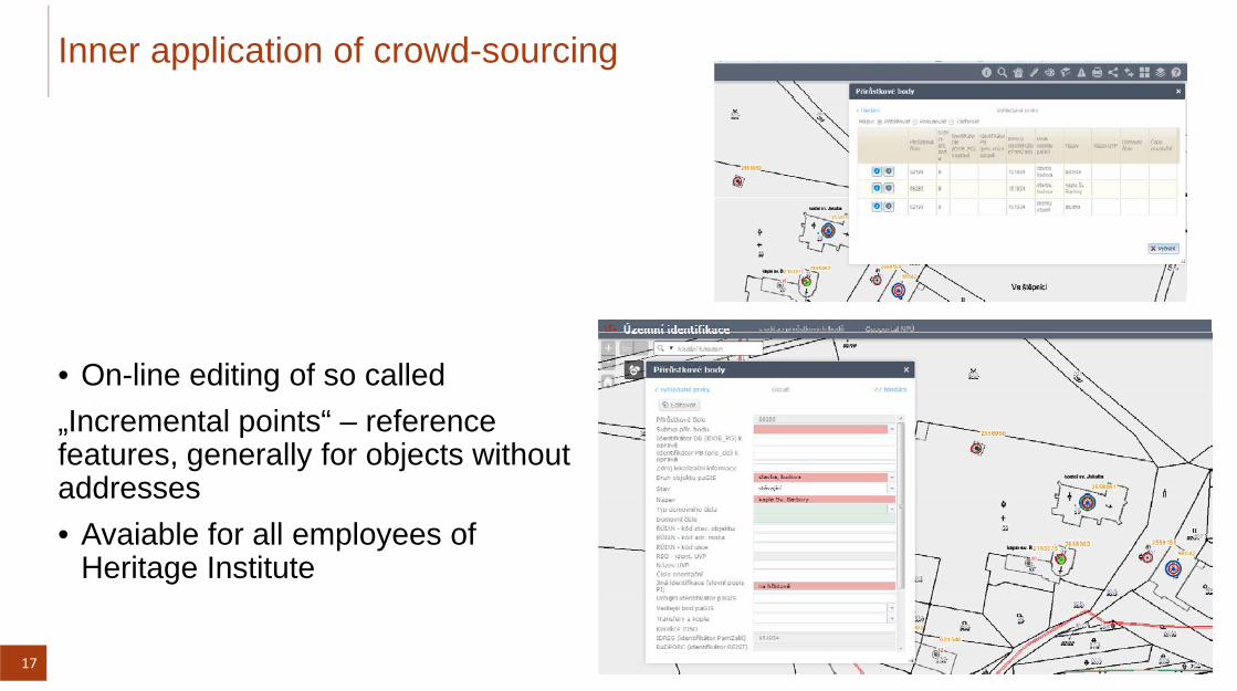
• On-line editing of so called„Incremental points“ – reference features, generally for objects withoutaddressesaddresses• Avaiable for all employees of
Heritage Institute
17
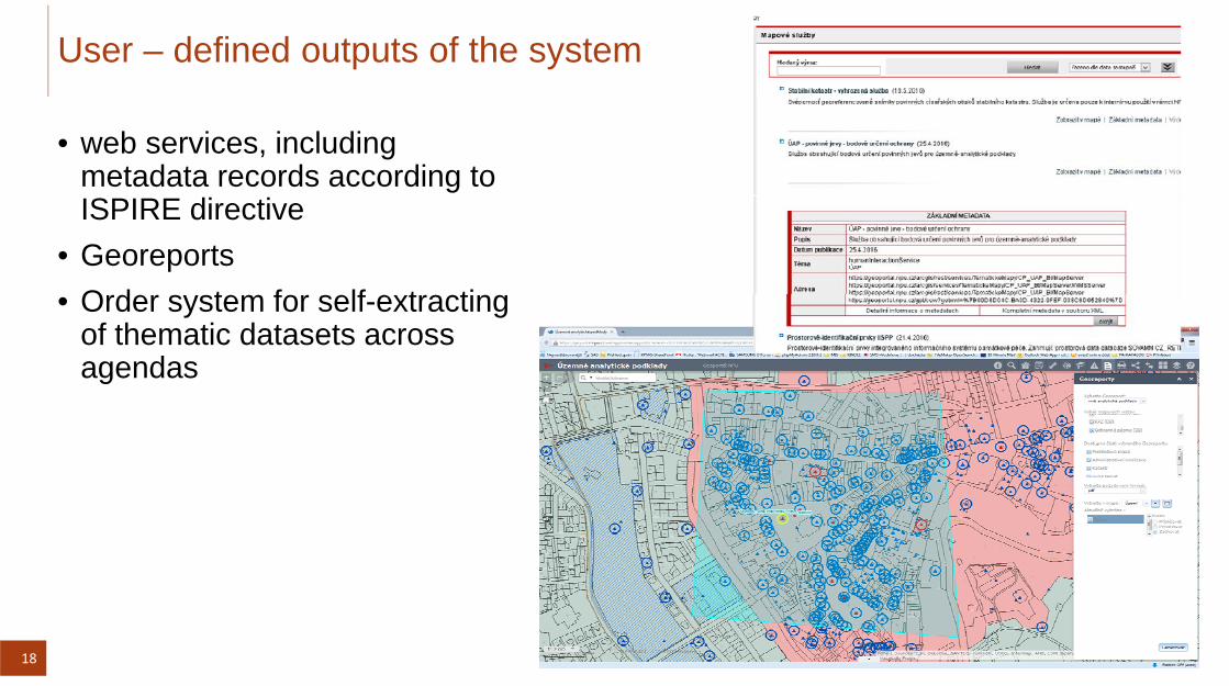
User – defined outputs of the system
• web services, includingmetadata records according to ISPIRE directive
• GeoreportsO d t f lf t ti• Order system for self-extractingof thematic datasets acrossagendas
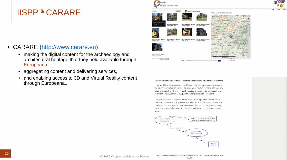
CARARE (htt // )• CARARE (http://www.carare.eu) • making the digital content for the archaeology and
architectural heritage that they hold available through Europeana,
• aggregating content and delivering services,• and enabling access to 3D and Virtual Reality content
through Europeana..
20CARARE Mapping and Metadata Schema
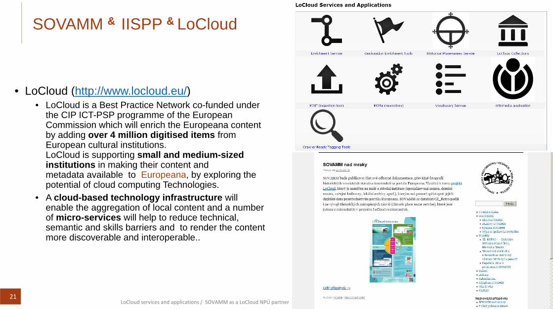
SOVAMM & IISPP & LoCloud
L Cl d (htt // l l d /)• LoCloud (http://www.locloud.eu/) • LoCloud is a Best Practice Network co-funded under
the CIP ICT-PSP programme of the European Commission which will enrich the Europeana content b ddi 4 illi di iti d it fby adding over 4 million digitised items from European cultural institutions. LoCloud is supporting small and medium-sized institutions in making their content and metadata available to Europeana, by exploring themetadata available to Europeana, by exploring the potential of cloud computing Technologies.
• A cloud-based technology infrastructure will enable the aggregation of local content and a number of micro-services will help to reduce technical, p ,semantic and skills barriers and to render the content more discoverable and interoperable..
21LoCloud services and applications / SOVAMM as a LoCloud NPÚ partner
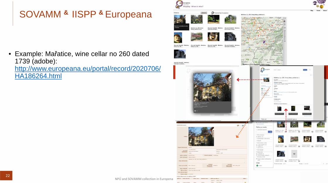
SOVAMM & IISPP & Europeana
E l M ř ti i ll 260 d t d• Example: Mařatice, wine cellar no 260 dated 1739 (adobe): http://www.europeana.eu/portal/record/2020706/HA186264.html
22NPÚ and SOVAMM collection in Europena
Austria-Hungary & Europeana
D t f diff t ti• Documents from different sources meeting on Europeana
• Austrian National Library• Slovak museum in Uherské HradištěSlovak museum in Uherské Hradiště• Ethnographic Museum of the National Museum in
Prague
• Example: Mařatice (distr. Uherské Hradiště), village houses
• Josef Klvaňa, 1857-1919 (photos before 1905/1918)• Hugo Charlemont, 1850-1939 (drawing before 1902)
23Houses in Mařatice, Josef Klvaňa before 1905/1918 / House in Mařatice, Hugo Charlemont before 1902